Over the past few months, I had seen a few passing mentions of a place informally called “the end of the world” not too far from where I live. The handful of pics I found showed expansive, breathtaking views of cliffs, canyons, and the red rocks of Sedona. This was a definite must-see. I thought July 4th would be the perfect excuse to go seek out this mysterious place. We invited some friends and made plans. What ensued ended up being quite a story.
I set to work figuring out where this place actually is. Apparently, it’s not well-known. Social media mentions and one recently posted Reddit thread was pretty much all I had to go off of. They mentioned one forest road and a general vicinity, but that was about it. I asked lots of local, adventure-loving friends and none of them knew anything about it.
So, Google Maps was pretty much my only hope. I could at least narrow down an area from clues I’d seen elsewhere. Using Google’s satellite view, I was able to find the forest road that ran more or less alongside the rim. From the satellite view, the edge is, well, pretty darn obvious, so that was helpful. Zooming in further with the satellite view on, I spotted several small roads that spurred off of the main forest road and went basically all the way out to the rim’s edge. These spots were where I hoped I would see the vistas.
Trying to figure out directions on my own was a bit difficult, so I dropped a pin on the place I wanted to go, and surprisingly, Google was able to give me navigation info using the forest roads. The most useful part of this was being able to see the whole route highlighted so I could study it. According to the navigation, I had two options for a route. They converged at the end, but were different for the first part of the trek–one came in from the north, and one from the east. I chose the one from the east, because Google said it would be shorter, and, more importantly, there were less crossroads. Forest roads aren’t always very well-marked, and it can be disorienting to be deep in the forest not really knowing which road you’re on. So, I figured the one with less crossings would be better.
Boy was I wrong. SO, SO WRONG.
Armed with directions and a naive sense of excitement, we set out Saturday morning. My man recently injured his arm, so I figured it would be best if I drove. I drive a high-clearance, 4WD SUV, which was perfectly suited to the occasion. We drove a ways down the highway before reaching the forest road turnoff. We passed tons of holiday weekend campers as we cruised along the dirt road. Before too long, the crowds thinned and things started to get muddy and a bit rocky. Monsoon season started last week, and there had been a huge downpour the night before. I switched to 4WD and got down to business.
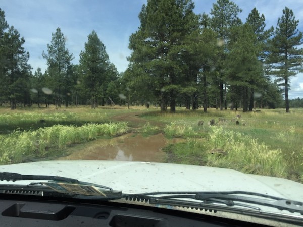
As we drove further into the forest, the road became worse and worse. Grass grew over the road (not necessarily a bad thing–more traction!), and in some places I could barely make out where the road actually was. The situation quickly escalated from a little rugged to incredibly stressful. My off-road driving experience is minimal, and while I know the concepts, I’m not very confident. Giant puddles sprawled across the entire width of the road (trust me, this photo doesn’t do it justice), often with trees and/or rocks lining either side, which made navigating around the puddles very tricky. Deep ruts of mud and water threatened to trap my car’s tires.
We were maybe 1/3 of the way into the forest when the map told us we needed to turn left. We were in the middle of a meadow, and believe me, there was NO road. I drove past it a little ways to see if maybe the GPS was a little off. I turned around and came back. Nothing. I had been crawling through the forest for over an hour, never exceeding 10 mph and navigating an endless, constant litany of off-road obstacles, stressing about the fact that what goes in must come out, and terrorizing myself with visions of doom of breaking my precious car and/or getting it stuck in the middle of the forest.
My nerves were completely shot. The map was wrong and we weren’t anywhere near our destination, which I now began to doubt we would ever reach.
I stopped the car in the middle of the meadow, incredibly frustrated and unsure what to do. My honey offered to drive, and my resolve was worn too thin to say no. Taking the passenger seat, I scanned the map and found a slightly different route that would meet up with the road we needed to get to. One-armed and all, he navigated much more confidently around the water, ruts, rocks, and trees while I studied the map and gave directions.
After maybe half an hour, we approached the intersection with the road that would take us back toward the cliff edge. Notably, this was also the other road that we could’ve taken to get in, the one I thought would be longer and more confusing.
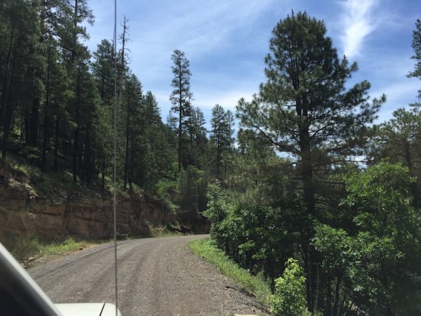
…The road was gravel.
Let me repeat that: after we just drove down a non-maintained road that threatened to drown or wreck my car at every turn, this road was GRAVEL. This was basically the lap of forest road luxury. I wanted to simultaneously laugh and cry. The good news was that we could take this road out, and we could wish that other sorry excuse for a road goodbye forever.
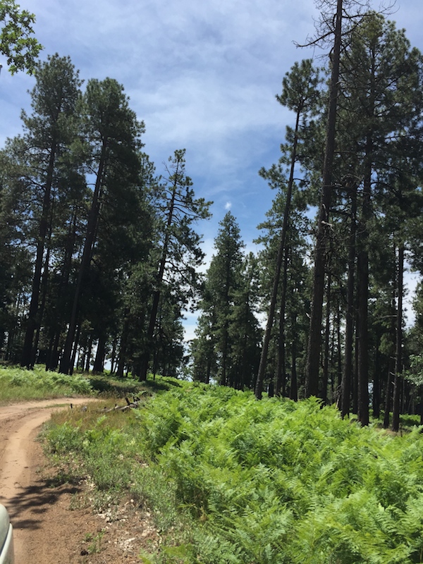
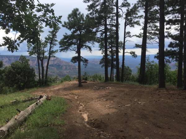
We breezed down the new road quickly. The drive was serene and beautiful, raising our spirits again. Ponderosa pines grew tall all around, with lush ferns and other green brush filling in the space on the forest floor. After a while, the road turned into dirt instead of gravel, and although a few large puddles popped up, it wasn’t even half as bad as the first road. After another 8 miles or so, we reached the first turnoff that I expected would lead us to an overlook. At this point, I still carried a kernel of doubt that this would all be for naught and we wouldn’t find an overlook after all. As we made the turn to head south, I could see a break in the tree line, a very good sign.
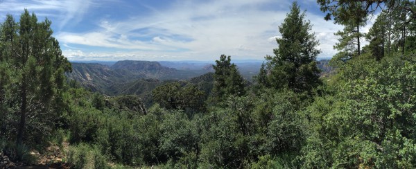
As we parked the car at the end of the road, I knew we had made it. I leapt out of the car, bounded to the clearing in the trees, and there it was! I was positively giddy. I had done it, I had found the secret place! Although this first overlook was pretty heavily treed, the views did not disappoint.
It’s pretty funny to me that in most places, if something like this existed, I’m sure it would be built up into some kind of popular local attraction. “Look at what we’ve got! Isn’t it amaaaaaazing?”
Not in northern Arizona. In northern AZ, it’s like, “meh, we have like a million other amazing spots where that came from”. Hah. (It’s true though.)
Anyway, we didn’t spend too long at this first spot before moving on to the next potential overlook, which was less than a mile down the road further east. (Btw, you can click these panos if you want to see a larger version.)
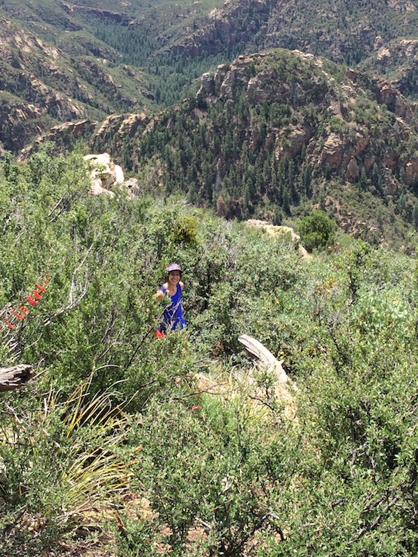
The next overlook was much more open, and there was a small, slightly overgrown trail that took us down a little ways and out onto a small rocky point for more panoramic views. The trail actually descended quite a bit further down beyond where we went–I think the trail is mainly used by wildlife. We lingered a bit longer here, snapping lots of pics before moving on to our third and final stop of the day.
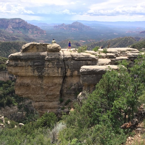
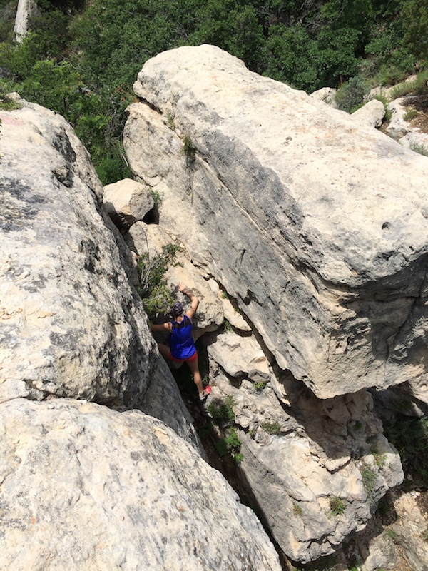
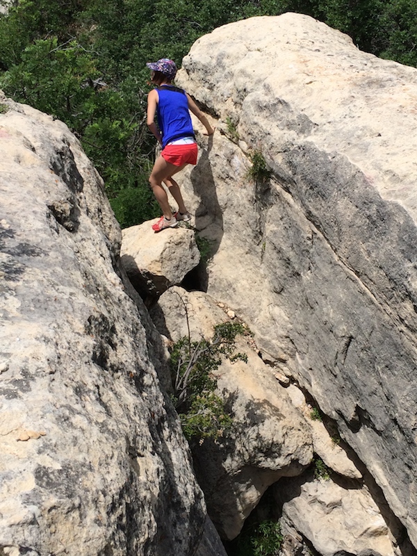
Arriving at the last viewpoint, a large rock formation loomed high, blocking some of the view. At first, this was a bit of a letdown. Because the rock is pretty vertical, it looked like there would be no way to get up on top of it. But my honey, went poking around and found a path that led down to the base of the rock, revealing a hidden nook with a climb-able path. Janky arm and all, he still scaled it more easily than the rest of us.
I scrambled my way up to the top unscathed. It was pretty manageable, except for the last pull up onto the top of rock, where I needed a little help thanks to my short legs.
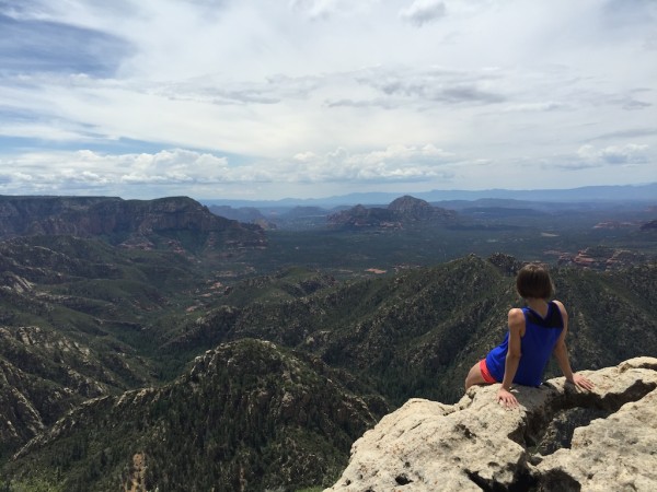
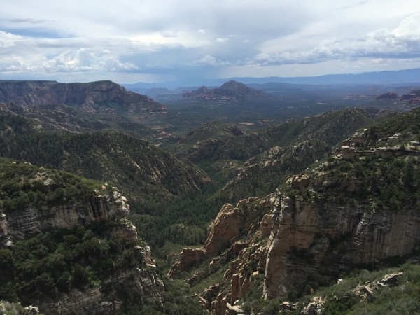
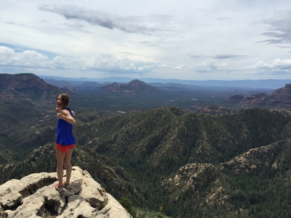
Since this viewpoint is nestled a little further back into a nook, the earth fell away in front of us in stunning canyon-like formations, framing the vista beautifully. We sat for a while, enjoying the solitude, the quiet, a little snack, and some celebratory beverages. Off-roading into the wilderness and parking ourselves here for a little while seemed like a legitimate “hell yeah freedom, hell yeah America” kind of day. At this point, it was early afternoon, which meant wind and clouds were starting to roll in. In the distance, you can see the hazy, blue-toned sign of rain that had already found its way to Sedona.
This collection of vistas mostly overlook the Red Rock Secret Canyon Wilderness, a nature area preserved by special federal laws, largely untouched by human development and home to many beautiful and diverse natural phenomena. Looking south is an exercise in geology: the lightly tan rock formations and the dense pines of the forest give way to the stark red rocks of Sedona further south. If you look closely, you can spot some of the more well-known Sedona points of interest like Bell Rock.
To get a little more geologically nerdy on you, you’re looking at part of the Mogollon Rim, which defines the edge of the Colorado Plateau, the vast geological formation that elevates large swaths of AZ, CO, NM, and UT. With that in mind, you’re looking at a drop in elevation of about 2,000 ft from where this photo was taken to the floor of Sedona.
One of the things I didn’t know until after this trip (that would’ve been really useful!) is a feature in Google Earth that’s basically the equivalent of street view for nature. If you get on a computer (not sure if it works on mobile), turn on earth view, then zoom in on an area of interest, there’s a feed at the bottom that will show you user-submitted photos in that area. Hovering over the photos will pinpoint the actual location where the photo was taken. For example, zooming in here on Humphrey’s Peak (a 12,637 ft peak local to me), you can scroll through quite a few cool panoramas people have taken from various viewpoints and trails on the mountain. As you zoom in further, Google will show you a more specific selection of photos.
This feature is actually really handy for discovering cool spots in your area. As I panned around the area I explored this weekend, the pics helped pointed out a ton more cool viewpoints, trails, and canyons that look really awesome. I would definitely encourage you to poke around in your own area (or somewhere you’re vacationing to) and see if there’s something new to be discovered–maybe you’ll be inspired!
Overall, this was definitely quite the eventful expedition! Although it took over 2 hours to reach this place going the bumpy way, it only took us about 30 or 45 minutes to get out the way with the nicer road. I’m so glad there ended up being a faster, simpler way in and out, since it means I can go back without being mildly re-traumatized. :) I’m so excited and proud I managed to hunt down such an incredible place, and I’m excited I’ll get to go back and explore more.




Loved the story! I’m pretty active on Reddit and I’m pretty sure I’ve seen pictures there. It’s absolutely gorgeous! Glad that you finally found it, and thank goodness for gravel roads ;)
Yeah there was one just a couple of weeks ago, actually. I’m not a big reddit person but I happened to stumble upon it, luckily. :)
So amazing!
Forget the beach, I know where my next vacation should be.
Hehe, I agree, much better than the beach. ;)
this is so beautiful!! wow!!
Isn’t it, though?! Pictures could hardly do it justice.
Gorgeous! And your tale of getting there was fab :)
Thank you!! :)
What a great adventure, especially on the 4th of July! We have used Google Earth to find places like that, but it does require detective skills. About the stressful driving on crazy roads–that happens to us on every single vacation. We rent SUVs but don’t drive one at home and then somehow manage to go on the worst, scariest roads when trying to find off-the-beaten path places. It even happened to us in Hawaii, when we felt sure that because of all the tourism the roads would be maintained. Nope. I usually end up in tears, and we usually end up yelling at each other because we’re so stressed…but somehow we keep doing it. So, I totally empathize! Glad you found not only such a great place but a better road to get out!
Ugh, I feel those feels. :( We had friends with us, otherwise I probably would’ve lost my cool more than I did. I’m glad it sounds like you’ve never wound up stuck in some ditch somewhere, eek. Maybe your off-roading skills are better than you think. ;)
Loved the story and pics!!
Thank you, I’m glad!
As much as I love your lulu intel—I think I love these posts even more. Gorgeous exciting views and post! LOOOOOOVVVVEEE IT! Thanks for lettingme live vicariously through you!
Aw thanks Sarah! Happy to hear you liked the post, sometimes it feels like I’m taking a shot in the dark when I’m hitting publish, lol.
We lived in Sedona and Grand Canyon before moving to California, and don’t think I knew about this – may have to check it out next time we’re back in the area (have family there). Sounds like you had such a fun time!!! PS – Our favorite canyoneering is that area too, but need to be able to setup ropes and rapel into water, James Canyon. I so miss northern Arizona, thanks for helping me reminisce! And drew me in with your description!!
Just did some googling, James Canyon looks pretty cool! Thanks for the tip! I’ve never been canyoneering, but that’ll have to be on the list when I learn. :) If you want more info about how to find this spot next time you’re in the area, let me know and I’m happy to help out!
That’s radical! It reminds me of a few excursions I took with family into the mountains of New Mexico as a teen – the roads/trails were treacherous, but we were always rewarded with something of natural beauty, like an amazing view or deep, primordial valleys and forests that seemed to have been untouched for centuries. Looking back, those are some of my favorite memories!
Beautiful photos, too!
The west is a crazy place, isn’t it? :) Those sound like some great memories indeed.
Hey glad we came across this we are headed there this weekend and like you had planned on coming in from the east. when you say the north are you talking about woody mountain road or cutting over on purple sage? after reading this here is what i pieced together on google earth it looks good and we are not opposed to some romping but coming from the valley we want to go the faster way to try and save time so we have light still when we get there? Please let me know your thoughts: Thanks
https://www.google.com/maps/dir/Scottsdale,+AZ+85260/35.1785443,-111.6981482/34.9846355,-111.8122504/@35.108931,-111.7870186,12.79z/data=!4m15!4m14!1m5!1m1!1s0x872b75a5cff59747:0xc0e0a28bc3ee3eed!2m2!1d-111.8926303!2d33.6160293!1m5!3m4!1m2!1d-111.7811101!2d35.1413918!3s0x872d8376b96acd11:0xfc7aebcc0d93d979!1m0!3e0
Hey glad we came across this we are headed there this weekend and like you had planned on coming in from the east. when you say the north are you talking about woody mountain road or cutting over on purple sage? after reading this here is what i pieced together on google earth it looks good and we are not opposed to some romping but coming from the valley we want to go the faster way to try and save time so we have light still when we get there? Please let me know your thoughts: Thanks https://goo.gl/maps/tdYyH @AgentAthletica
map wont pop up the way i have it but basiclly you are saying the gray route is the way to go?
Hey Jason! Glad you found it too. :) I hope the weather holds if you make it up here this weekend! Looks like we’re expecting a bit of rain. Anyway, I can see from your map attachment that Google is suggesting you take FR536 right off of 89. These are the same directions Google gave me, and so when I talked about coming from the east, FR536 is what I was referring to (and when mentioned the route “from the north”, I meant Woody Mountain, i.e. the grey route in the map). So to be totally clear, I definitely recommend that you avoid FR536 like the plague!! It would take you forever to go that way. I recommend you take Woody Mountain (aka FR231) the whole way in. The road is gravel most of the way, but dirt for the last several miles so you’ll still get some romping. :) If you have other q’s, you can also feel free to email me–there’s a link up in my sidebar.
Awesome thanks and i meant next weekend so weather is looking good!
Oh, even better! Good luck. :)