
You know that Lord of the Rings meme where Boromir says “one does not simply walk into Mordor“?
Well, I simply walked into Mordor.
When I was a teenager, I was a huge Lord of the Rings nerd. I read The Silmarillion. I had an Elvish translator app on my computer (both Sindarin and Quenya, thanks). There’s a mildly embarrassing picture of me posing with my Sting replica in front of my favorite trilogy posters. I wore a handmade Eowyn costume to the Return of the King premiere, which still hangs in my closet. Needless to say, I was pretty all-in.
Finally visiting the “real Middle Earth” meant I could NOT miss the chance to take a walk through Mordor. Aside from its famous role in the LOTR movies, the Tongariro Alpine Crossing holds its own as a must-do day hike in New Zealand.
The crossing traverses extremely varied, wild terrain. It passes by myriad geological phenomena, like active volcanoes, steam vents, and brightly colored alpine lakes.
Without any summit trek add-ons, the crossing is 19.4 km one-way, or about 12 miles. Since there are plenty of services that provide transportation to and from either end of the trail, most people hike it one-way. The popular direction is to hike south to north from Mangatepopo to Ketahi, since this direction involves more going down and less going up. All told, you climb about 760 m up and descend about 1120 m. That’s about 2500 ft and 4000 ft, respectively, so it’s a pretty serious volume of hiking.
We got our start around 8:30 am. Our driver told us to be out the other side and ready to be picked up at 4:00 pm. The 7.5 hours was totally manageable for a 12-mile hike, but we wanted to add in a side trip to the summit of Mt Ngauruhoe, which was said to take 2-3 hours all by itself.
Basically, we had our work cut out for us if we wanted to make it through the 12-mile hike and the summit side trip.
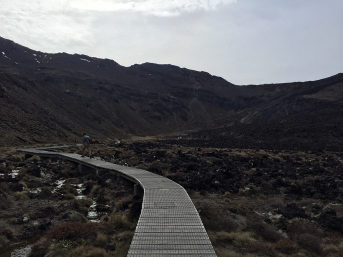
The first bit of the track winds through a desolate, marshy area. The track alternated between solid ground and an elevated boardwalk above the Mangatepopo Stream. It was easy to see why the filmmakers chose this spot as Mordor. I could totally imagine orcs popping out from a corner. The cloudy, cold day enhanced the desolate feel of the wilderness.
As you can see from the photos here and later the post, this trail is exceptionally well-maintained. Honeycomb fixtures in the soil guard against erosion and aided in traction, the boardwalks are flawless, and stairs are neatly installed in many of the steeper areas. Several stretches of trail even have small plywood borders on the side. Major kudos to the tremendous amount of work the National Park employees put into this track.
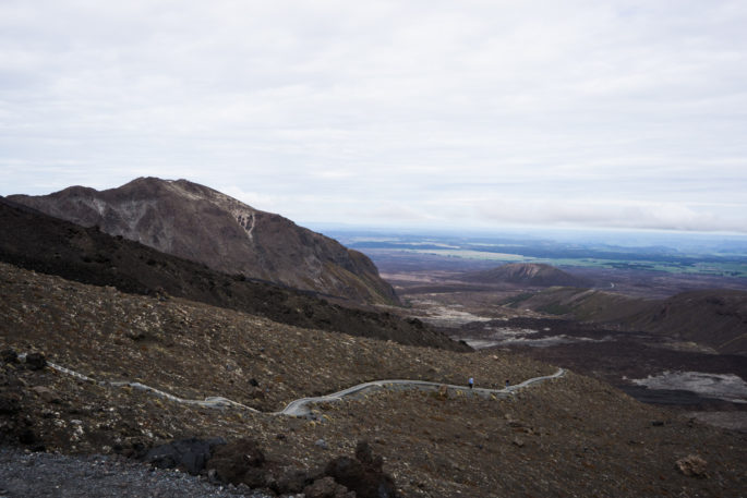
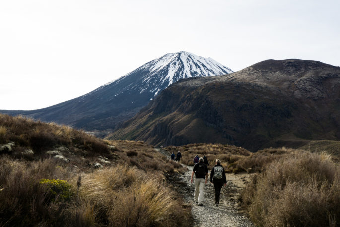
Shortly into the hike, the steepest section begins as you make your way up from Soda Springs to South Crater. After about an hour of wheezing and climbing, we arrived at a plateau and the start of the Mt Ngauruhoe side trip (the mountain in the photo at the top of the post). If you were wondering, the pronunciation is roughly similar to “now-roo-ho-ee”. This active volcano served as Mt Doom in the Lord of the Rings movies, so the (admittedly nerdy) significance of climbing Mt Doom was not lost on us.
It was around 10 am at this point. We decided we had enough time to at least try to make the summit. We planned to watch the time and simply turn back early if we felt it was taking too long.
The ascent up the mountain was frustrating and painful, to say the least. After an intense hour of climbing on the normal part of the trail, my legs already felt smoked. Starting a brutal ascent on heavy legs was not exactly enticing, but I refused to pass up the opportunity to climb Mt Doom.
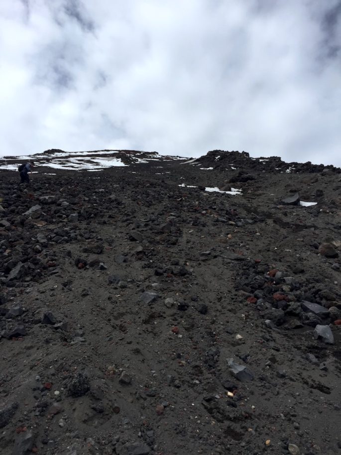
Ascending the mountain was like trying to walk up a sand dune. The the volcano is covered in scree, which is sort of like a cross between sand and gravel. It was very difficult to get traction on the loose rock, which meant for every two steps you take forward, you slide back one. Fortunately, I had hiking poles, which helped me find a little bit of traction on the ascent.
The mountain is steep. Really, stupid-crazy steep, and not a single switchback to help you. From what I’ve read, it’s about a 30-degree angle. If it was any steeper, I’m pretty sure you’d have to crawl. The photo above really captures the punishing climb. Unlike the rest of the hike, the trail to the summit is only vaguely marked. With the scree, it would be difficult to build a trail at all. The only markings were in the form of the occasional tall, thin pole.
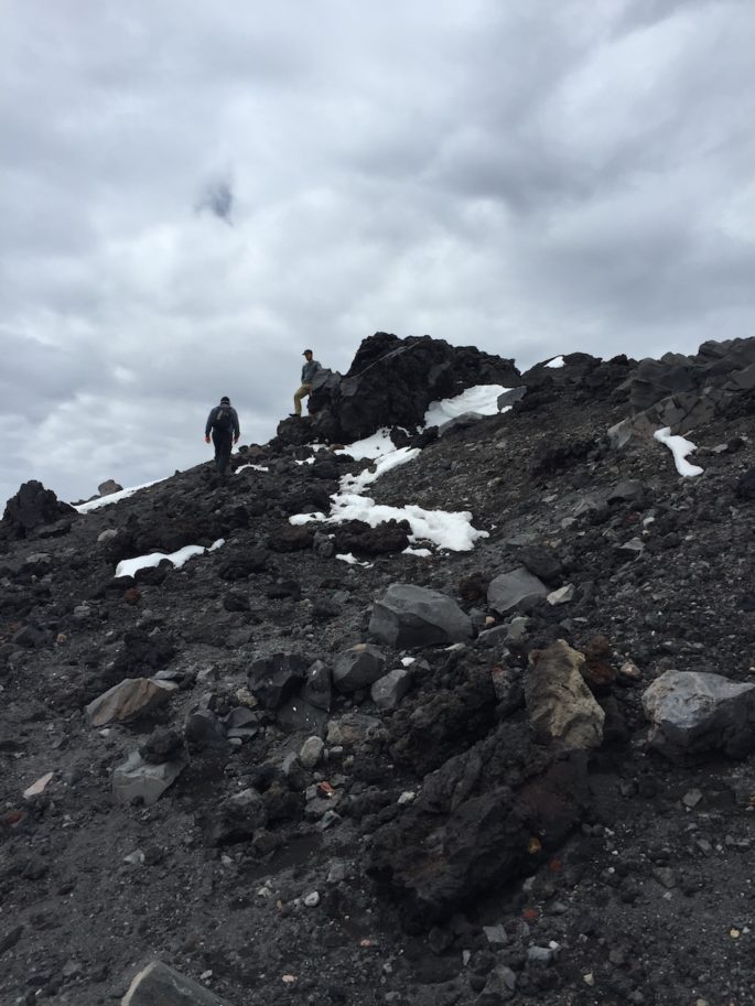
As we started making our way up the foot of the mountain, we veered right over to the “ribs” of the mountain, where larger rock formations from lava flow lodged themselves in the side of the mountain. Once we got there, our ascent transitioned to a scramble. I put my poles away and used my hands to pull myself up the lava flow. The rocks were quite sharp and I was so glad I brought gloves.
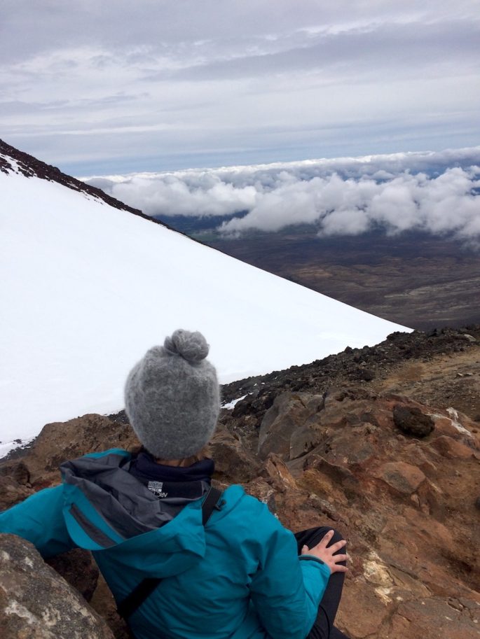
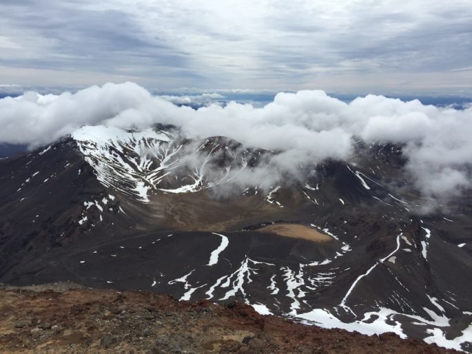
After about an hour and a half, we arrived at the top. Being an active volcano, it’s not incredibly obvious where the mountain’s true summit lies. The snow-covered ridge of the inner crater loomed to our left, and the true summit lay just behind us. If you note the red, non-snowy peak in this aerial photo, that’s where I was, whereas the true summit is the pointy, snowy peak.
The true summit was only slightly higher than where we were, and would require walking a couple hundred feet behind us along a precarious ridge (as shown in the aerial photo) with fairly high wind to boot. I was sooooo done climbing at that point that I was ok with stopping where we did, just a hair shy of the real summit. I’m not that much of a purist.
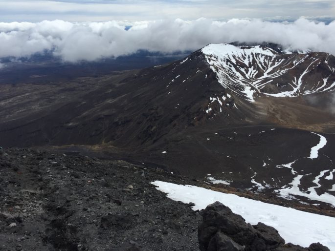
The view from the top was striking. We could see the faint ribbon of the trail far below us, and numerous lakes off in the distance. Volcanic vents poured out steam around us, creating mist and clouds.
We sat for a couple minutes, but time was not on our side. Plus, the wind and cold at the top was brutal, so we moved along after a few quick photos.
If you think the ascent is bad, try going down. I would’ve gone up twice more if it meant skipping going down, and that’s saying something. I was awfully jealous of Frodo and Sam, who didn’t have to descend and instead got flown off by eagles. Alas, no eagles came to my rescue.
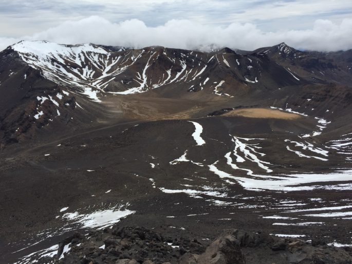
Looking around from the top is terrifying. There is nothing between you and the base of the mountain 2000 ft below. If you lose control, there is absolutely nothing to stop you from careening wildly to the bottom. Remember how I said it’s a 30 degree angle? Just imagine looking straight down at that with nothing to grab onto. You can get a vague sense of how steep it was from that photo, though the height and angle were difficult to capture.
For the initial part of the descent, the rock is partially packed, and partially loose, which was the worst combination. It’s just packed enough that I couldn’t bury my feet in the scree as an anchor of sorts, but it was loose enough that I felt like I could easily lose traction and slip.
To start making my way down, I literally sat down on my rear and scooched/crab walked my way down. My morale plummeted almost instantly. On the slow climb up, I had been counting on the descent going quickly to make up for the lengthy ascent. You can imagine the rude awakening when the descent turned out to be agonizingly slow as well. I felt like I was never going to get off that godforsaken mountain. “Everything hurts and I’m dying” was a pretty apt description of how I felt at the time.
After about 15 minutes of scooching, walking a little, getting scared, and scooching some more, I was biting back tears. I was genuinely frightened. If you’ve ever done Angel’s Landing in Zion National Park, it’s like that, but worse, because you have no chains. I had no problems with Angel’s Landing and would love to do it again, but Mt Ngauruhoe was downright horrifying. I don’t know how the other hikers around me were able to descend from the summit so quickly, because my descent was laughably slow. “Mt Doom” certainly lived up to its name.
About halfway down, I started to feel slightly more comfortable since I wasn’t so dizzyingly high anymore. The scree becomes more “sandy” near the base, so I started to get the hang of “surfing” my way down and letting the sliding momentum carry me forward to my next step. As I started to move more quickly, my adrenaline and fear started to clear.
This shows you just how loose the scree is:
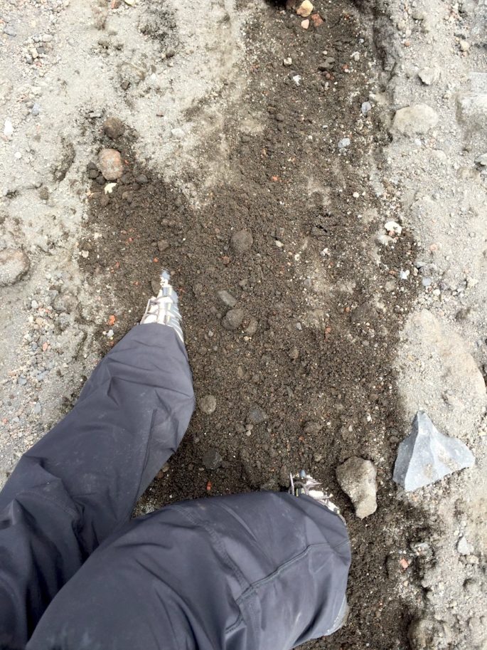
It would easily devour your whole foot if you let it! That said, being able to dig in your heel and bury your foot completely really helped me feel like I wasn’t going to slip. Perhaps I could’ve “surfed” down like this starting from the summit, but I was too scared to try. After picking up speed, the descent took a total of just under an hour.
At this point, it was around 12:45. We had burned more than half of our total hiking time and had a bit less than 4 hours to make it another 13 km to catch our ride.
Holy crap.
This translated to about a 2.5 mile hiking pace. While not impossible, we were going to have to really put the pedal to the medal, in spite of our burnt out legs. We shook the scree out of our shoes and got to work. I stuffed half my sandwich in my face while we walked–no time for lunch!
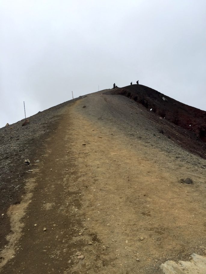
Despite the daunting task ahead of us, I was in better spirits with Mt Doom behind us. I was proud to have made it, to have crossed it off my list, and to have ended the summit trip on a good note. The rest of the hike didn’t seem so scary by comparison. After a brief trek across a plateau, we arrived at the final ascent to Red Crater.
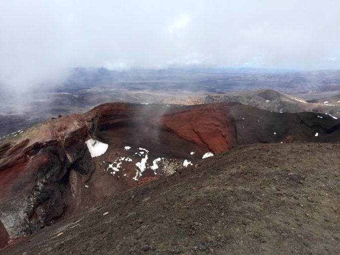
It’s pretty obvious where Red Crater gets its name. High concentrations of iron in the soil give it its distinctive rusty hue. Old lava flows streaked the side of the crater and into the valley below.
Red Crater is the high point of the alpine crossing, and the segment after it is the true alpine crossing. The winds at this point were hurricane-level powerful. In fact, the wind levels are largely what determine whether the Crossing is safe to attempt. It was a relatively calm day, but the bitterly cold wind still gusted strongly enough to make me stumble if I wasn’t careful. Here we encountered some more scree on the ups and downs of the trail, but fortunately, Mt Ngauruhoe got me well-accustomed to this tricky terrain and I negotiated this section quickly.
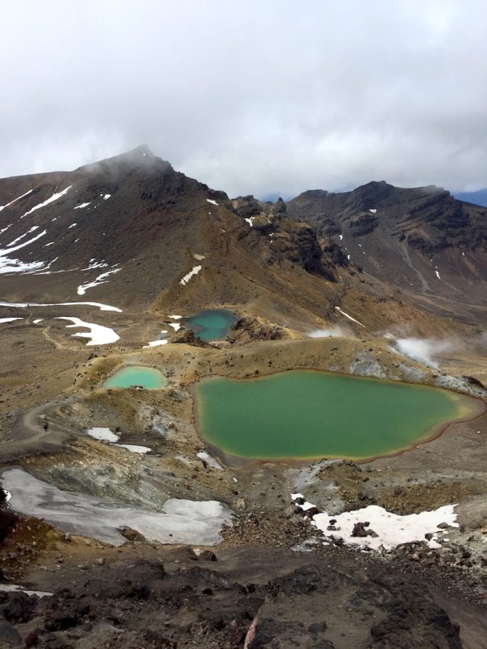
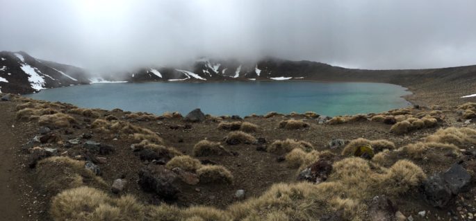
Here, you pass a series of beautifully jewel-toned alpine lakes, colored by the rich minerals of the volcanic landscape. The wind whipped across the lakes, creating dramatic ripples.
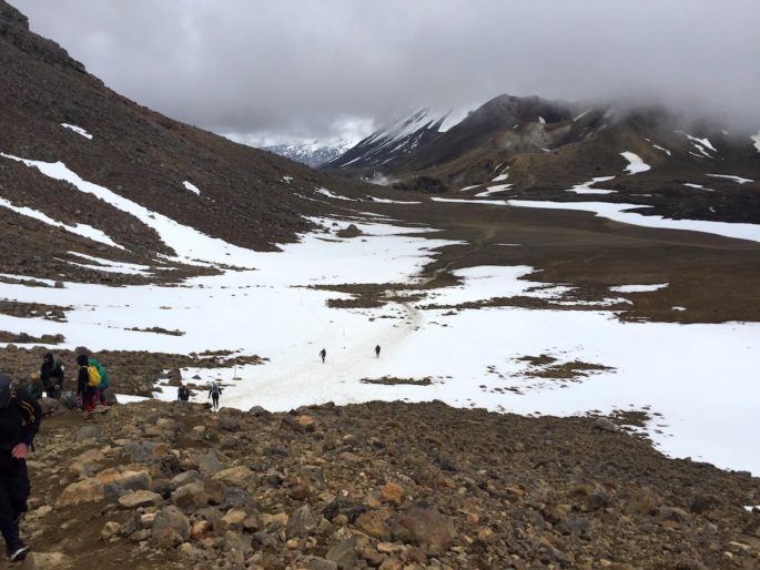
We made our way across the plateau, and crested one last ridge, leaving the alpine terrain behind us. Another dramatic shift in scenery awaited on the other side of the ridge. Brown grass carpeted the land around us, and we could see vast lakes and farmland in the distance. Steam vents billowed tremendous clouds from the hillside and the wind died down.
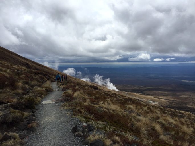
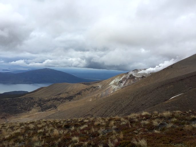
From here, the track stretched on for miles and miles looking pretty much just like this, snaking around the hillside and past a bubbling creek. As we ventured further and further from the volcanic field, plant life became plentiful. After a couple hours of this, it was incredibly tempting to think that the car park would be just around the next dip or curve. (Hint: it wasn’t.)
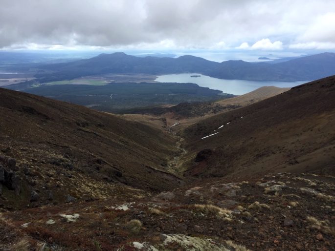

With the downhill slope in our favor, we kept up a solid pace, noting our time at each distance marker, racing against the clock. For much of the downhill portions, we let gravity take hold and ran downhill to help make up precious time.
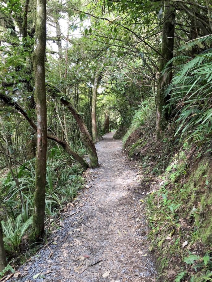
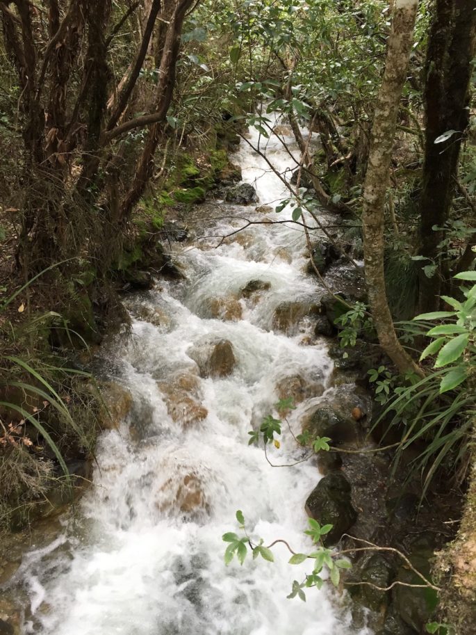
After rounding another bend, the scenery underwent one more radical transformation: we suddenly found ourselves in thick, bright green bush. It was mind-boggling to go from bleak, volcanic terrain to such a lively environment in the space of only a few miles. New Zealand makes up for being such a small country by packing an insane amount of variety in really small spaces. The vibrant bush walk with the rushing stream alongside us was a wonderful way to close out a grueling day of hiking.
We emerged at the car park at 4:30. Despite our tardy arrival and our lengthy detour to Mt Ngauruhoe, we and another couple walking with us were still the first hikers to arrive back at our van. (We only beat the others in our group by about 20 minutes.)
The summit side trip added about 650 m (about 2000 ft) of climbing to our trip, bringing our elevation gain total to nearly 5000 ft, plus that much and more going down. I definitely count this among the most strenuous hikes I’ve done!
Leave it to New Zealand to deliver a hugely varied, undeniably memorable, adrenaline-filled, leg-annihilating walk!


These are stunning!! I’m glad you were able to fit it all in!
In addition to your photos being gorgeous, the “When I was a teenager…” paragraph at the beginning includes that best material that you have EVER posted on your blog.
One amazing little disclosure after another…. wow :)
I was not lying either!!! https://agentathletica.com/wp-content/uploads/2017/01/suzandsting.jpg (that link will probably die soon, lol)
That took me FOREVER to dig up in my old external hard drive but OH MAN it was totally worth it. I’m dying over here.
ohmygooooosssssshhhhh. amazing.
i was in the passenger seat when i viewed that and my husband was driving. he glanced over, did a double take, swerved slightly, and said “WOW! WHO is THAT?!” (with a tone of stunned respect and awe). he was very pleased to see that other people love LOTR as much as him.
Hahaha that’s amazing! Virtual high fives to you both. :)
Oh P.S. I also forgot to mention that in that photo, I’m also wearing my elven leaf replica necklace thing which I wore religiously EVERY SINGLE DAY.
Awesome photos!
Thank you! :)
Love your photos and story! Your descent reminds me of my climb up/down Mount St. Helens — volcanic ash is super gravelly and takes a lot of extra work (definitely 1 step up, half step sliding back down). What helped me in coming down the volcanic ash was digging my heels in first for every step down (walking with your foot flexed pretty much for the entire time). That way, you slide/surf down a bit, but in a more controlled manner. Granted, I can totally understand any fear your might have experienced — particularly since climbing internationally seems so much more risky than domestic terrain (not sure why I think this). So nice to read about your awesome experience!
Yup, that’s exactly the technique I used! Near the top of the mountain, though, there just wasn’t enough to dig into with my heels, which made it scary since it was still gravelly enough to be slippery. :\ I think I was also just really taken off guard by the fear factor. With Angel’s Landing, for example, I knew exactly what I was getting into. With this mountain, I really wasn’t expecting it to be so scary, so mentally I don’t think I was prepared for it! While I was there, I swore up and down that I would never do it again, but I bet if I did it again it wouldn’t be nearly as scary the second time since I know what to expect.
I’m so jealous! I’ve tried to do this track twice but the weather was bad both times. Hopefully I’ll get to do it one day. Your pictures are fantastic!
Yeah, apparently it was bad both the day before and after we went! We definitely got lucky. I hope you get lucky someday too. :)