Last May, I set out to cross off a bucket list item of mine: hike to the bottom of the Grand Canyon and back in one day.
There’s a reason it’s called the GRAND Canyon: it’s huge. Hiking all the way in and out is no small feat. The typical rim-to-river route covers over 17 miles, including 4780 ft down and 4380 ft up. Most one-day hikes are nowhere near this intense. Instead, most people choose to stay the night in the bottom of the Canyon to break up the trip.
Last year’s rim-to-river trek was intense. I made it, but it felt like a bit of an ordeal. You can read my full recap of that trip here.
Since last year’s trip didn’t go as well as I hoped, I wanted to give it another try. I felt like my strategy for the day had lots of room for improvement. Basically, I wanted to go back and redeem myself.
A couple of weeks ago, I did exactly that.
Disclaimer: please remember to hike safe. Although it’s fun to share my stories and experiences, you’re responsible for your own safety. Know your own limits and abilities. Make sure you do plenty of research before attempting any big hike, including this one.
My alarm went off at the ripe hour of 3:45 AM Sunday morning. I put on sunscreen, fed my (very confused) dogs, grabbed my backpack, and got in the car. We were off by about 4:10. We drove the hour and a half to the Canyon by the light of the moon, dodging several groups of elk who were enjoying some hangout time in the middle of the road.
The descent
We parked at Bright Angel Lodge and made our way to the bus stop where we would ride the shuttle a few miles to the South Kaibab Trailhead. It was about 35 degrees and I was wearing shorts and a light jacket. Fellow hikers looked at me like I was nuts. Perhaps I was, but last year, I wore sweatpants for all of 20 minutes and then carried that extra weight for the next 9+ hours. Silliness. This year, I decided to just stick with the jacket instead since I didn’t want my pack to be unnecessarily heavy. Sure enough, I had warmed up within an hour of getting on the trail.
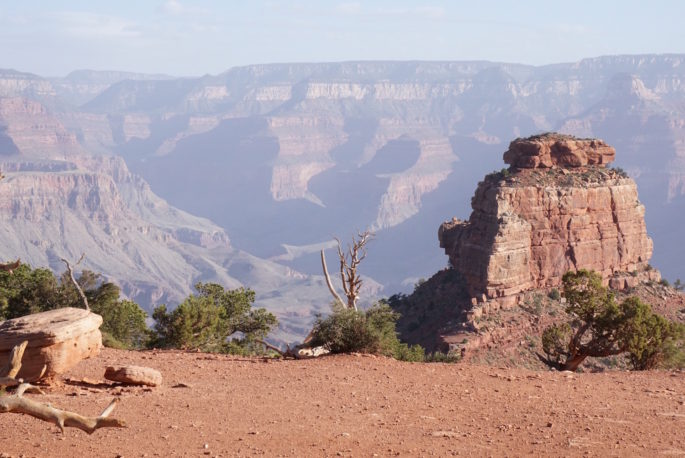
This time, it was very hazy early in the morning, dampening the usual sweeping views for a couple hours. (Photo: Cedar Ridge, 1.5 miles and 1140 ft down)
I still had last year’s photos on my phone, so I frequently referenced them to see how our pace compared with last year. Since we started at the exact same time of day (6:30 AM), I could check what time I took a photo last year versus the time we arrived at the same landmark this year.
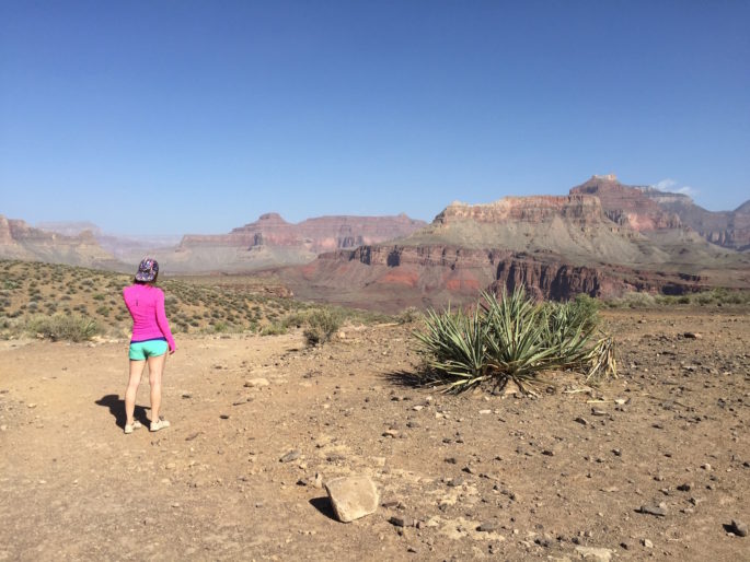
Unlike last time, this year’s hike was very empty. Last year we hiked on a Saturday and were accompanied by hikers for the entire descent. This time, we went on a Sunday, which I’m sure was a big contributor to the thinner crowds. We crossed a few hikers as they ascended the trail, but we were alone almost the entire descent. I’m used to heavy crowds at the Canyon, so the profound quiet was peaceful but a little strange. (Photo: Tip Off, 4.4 miles and 3260 ft down)
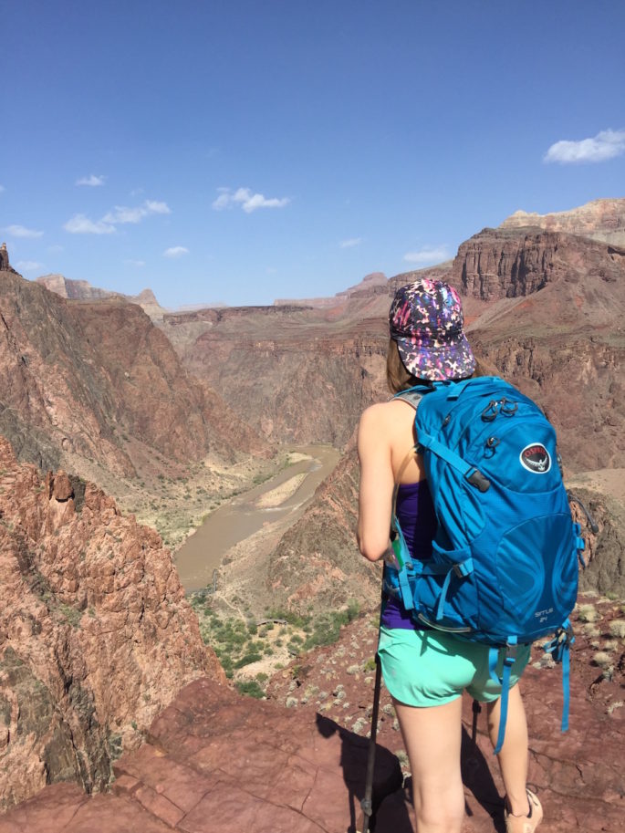
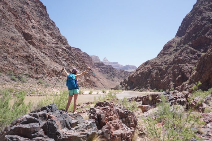
I missed this rad little overlook last year. It’s somewhere between Tip Off and the Black Bridge, almost all the way to the bottom. As you can see from the pics in this post, the Canyon has many “faces”, and this one is pretty cool. If you look closely, you can see the Silver Bridge just below my elbow and to my left. You can also see the trace of Bright Angel Trail winding next to the river. That’s where we would end up in just a couple of hours.
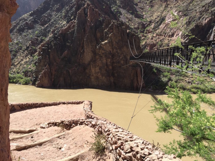
Last year, it took us 2.5 hours to reach the Black Bridge at the bottom of South Kaibab. This time, it took us 3 hours and 10 minutes, about 40 minutes longer. Unfortunately, my boyfriend’s knees were really bothering him on the way down, so our pace slowed more and more the further we descended.
You can imagine both of us were so relieved to reach the bottom. Besides being glad the jarring impact of the descent was over, the bottom is so peaceful. We hiked another mile or so along the river and found a spot by the creek (an offshoot of the river) to have our (very early) lunch.
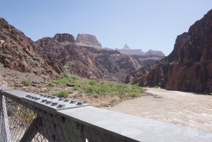
Once we finished our lunch, we hiked another couple miles to the unofficial start of the ascent. The annoying thing about this part of the hike is that you actually climb several hundred feet (some of it through sand, which sucks) only to descend right back down to the river. Basically, you’re hiking around a large rock formation (see overlook photo above) to get to a nook in the canyon where Bright Angel Trail carves out a path up the canyon walls. (Photo: Silver Bridge, about 9 miles and 4780 ft down)
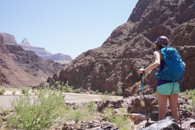
The last stop before leaving the river is Pipe Creek Beach. This is one of my favorite spots along the hike. There isn’t much water in Arizona, so the opportunity to sit and just listen to the river is wonderful. The weather in the bottom of the Canyon is usually oppressively hot, but that day it was perfect. I took the opportunity to lay down on a slab of rock and relax for a few minutes, just soaking up the perfectly clear air, the sunshine, and the sound of the river.
Since we had lost so much time on the descent, my boyfriend was impatient to get going again. Although we had plenty of daylight at our disposal, he didn’t want us to get home any later than we had to. We left Pipe Creek Beach around 11:30. This was only 15 minutes later than our departure from the beach last year, so we had already made up a fair amount of the time we’d lost on the descent.
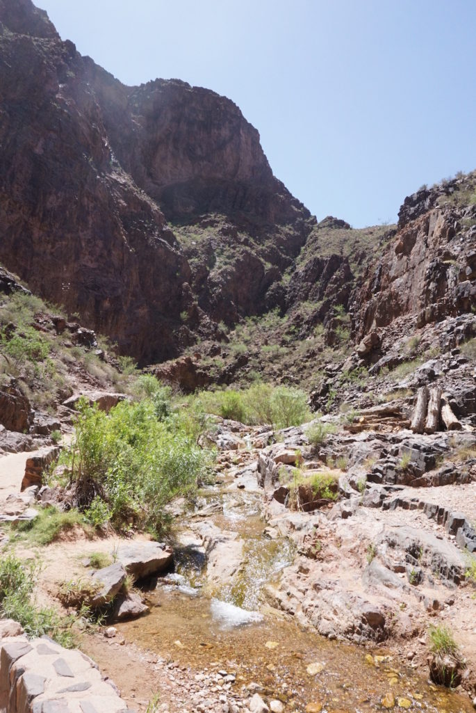
The ascent
Last year, I remember being miserable pretty much right away. I remember even hating the hike from the bridge to Pipe Creek Beach, and hating what came after even more. This year, I was surprised to find that a mile or two of the trail after Pipe Creek Beach was almost completely flat. It actually felt easy. I felt encouraged knowing that I was already doing better than last year on the daunting second half.
A couple miles away from the river, we reached the first switchback and I put on the brakes. Last year, I had to stop and rest every switchback or two and became so winded in the process that I could barely even speak. There’s a term for this called “redlining”. Just like how your car engine can exceed its maximum RPM and reach the red portion on your RPM gauge, your body can hit a maximum where stuff really starts to get ugly. Last year, I was redlining for pretty much 5 straight hours and it was not fun. At all.
This time, I paid much closer attention to how close I was to my redline. I kept reminding myself to slow down, even when my pace felt “too slow” already. Although I was working hard the whole time, when I felt my breath get a little bit ragged, I would pull back. It was surprising how much of a struggle controlling my pace was. My perennial problem is that I tend to go too hard too soon, making it difficult to properly recover and reset. Even what I feel like is “slow” is usually way too fast. I’m working on getting used to feeling what it’s like to settle in at a sustained 60-75% effort instead of a stop-and-go 100%. Understanding this difference and learning to pace is something I’ve been working on literally for years.
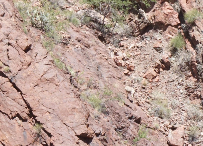
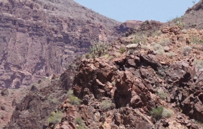
Sure enough, I covered many switchbacks without feeling the need to stop. But, we stopped anyway because we spotted a bighorn sheep! It was incredible to watch how it scaled hundreds of feet of canyon wall without any trouble at all.
When the sheep disappeared from view, we continued on. Before I knew it, we had reached Indian Gardens, which is just 4.8 miles and 3060 ft from the rim. My legs didn’t feel fresh by any stretch of the imagination, but I still felt ok. We took a slightly longer break here for some shade and a snack. I also took a dose of electrolytes. Granted, it wasn’t ULTRA hot and I didn’t feel like I was losing a ton of electrolytes, plus I’d eaten a fair amount of salty food. But I wanted to be cautious, so I guzzled a bottle of water with a Nuun tablet anyway.
Thankfully, at this point, my boyfriend’s knee pain had dissipated. I have no idea whether it was the ibuprofen or simply the fact that we weren’t going downhill anymore, but I was relieved that the worst was over for him. He was worried he had sprained one or both of his knees, and although they swelled that evening, he didn’t have any trouble with them later. Bullet, dodged.
After Indian Gardens, things really ramp up. The trail becomes a lot steeper and your legs are even more smoked than ever. I continued to remind myself to take it slow and steady. I only had to pause to rest one or two times along the 1.8 miles and 1000 ft between Indian Gardens and the 3 Mile Resthouse.
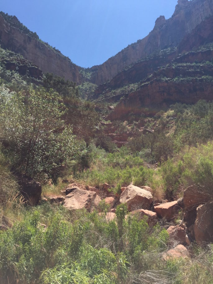
Usually, when you do really challenging hikes, the further you go, the more you’re rewarded with solitude. The Canyon is definitely not that way. Although we were pretty isolated in the morning, from Indian Gardens to the rim the crowds get steadily thicker. By the time you’re within a mile of the rim, it’s really crowded. If my memory serves, this picture was somewhere a bit after the 3 Mile Resthouse. We’d gone around 15 miles at this point but still had to hoist ourselves up to the rim in the distance.
I held onto an okay pace for the next 1.5 miles to the 1.5 Mile Resthouse. But after that, I really started to hit a wall. I had to take more frequent breaks even at what felt like a modest pace. Although I mentally felt ok, my body was starting to reach the next level of fatigue. Fortunately, since we were almost done, it was ok that I was starting to reach that redline. Funny, how I felt then, with only 1.5 miles to go, was about how I’d felt with 8 or 9 miles to go last year.
We took our final steps out of the Canyon at 3:45 PM, 9 hours and 15 minutes from when we set off. My pacing paid off, because this was 15 minutes faster than last year!
At the end this time, I felt so much better compared to last year! My legs were just about ready to give out, but I was in a good headspace. I was exhausted and relieved to be done, but if I’d had to go further, I definitely could’ve. Last year, I was literally wheezing from exertion as I stepped out onto the rim. This year, I practically ran out.
What worked this time
Eat more than I feel like I need. Last time I made a pretty key error: skimping on food. Even though it seemed like a reasonable amount of food at the time, I really don’t think it was enough fuel to get through such an energy-intensive effort. This time, I made a point to eat considerably more and supplement with plenty of snacks throughout the day. I think that made a big difference. Not only that, I also was sure to eat plenty in the days leading up to the hike, another thing I didn’t do well last year.
Take it easy on the descent. Although this strategy wasn’t planned, I think it was an important factor. Last year, I was excited and moved very quickly. This time, I slowed down partially because I was using hiking poles and partially because I had to slow down for my boyfriend’s knee pain. I think moving more slowly lessened the muscle fatigue and joint pain I accumulated in the first portion, leaving more in the tank for later.
Be mentally tough for the ascent. Last time, I was completely blindsided by the pain and effort of the ascent. Although I knew it would be hard, how quickly it became hard and exactly how difficult it was caught me off-guard. This totally threw off my entire mental game and I never quite recovered. This time, I knew what was coming.
Pace is key. As I described above, really making a point to slow down made my pace more sustainable and kept my head in the game. It also made me enjoy the hike more!
Little things add up. The hiking poles I used on the way down helped me on the way up, too, since I felt like I could “pull” myself up, which was helpful mentally, too. I took a little ibuprofen at the bottom that I think helped mitigate potential joint pain, which was significant last year. It was hot, but probably 10-15 degrees cooler than last year. I’d also done a couple of strenuous hikes in the couple of months leading up to this hike, whereas last year’s rim-to-river was my first really intense hike in about 6 months. Although it’s hard to say exactly which factors were most important, it all added up to a great success.
Now that I’ve redeemed myself with a truly successful rim-to-river trek, I feel more prepared to think about tackling the next level: a full rim-to-rim hike!


wow, that’s a load of helpful information! Thank you so much for writing it all down. I’d like to take the same hike someday when my kids are older so I’ll be hanging on to this! And congratulations!!
You’re welcome, I’m glad it was helpful! :)
Congratulations on a great hike! Last year’s recap included your food choices, what did you bring with you this year to snack on?
Almost the exact same things, actually! All this plus a sandwich and an apple. (This was for 2 people.)
Oh, another note: we didn’t eat ALL of what’s pictured there–it was a little bit more than we needed, but I brought extra on purpose. :)
Congrats, Suzanne. Very impressive! I’m so glad that you were able to “redeem” yourself. I look forward to hearing about your rim-to-rim hike next :) Isn’t the north rim about 1000 feet higher??? Yeehaw!!
It’s also quite a bit longer, more like 21-23 miles. Yeehaw indeed!!
What a beautiful and descriptive summary. Thank you so much for writing your colorful stories! It brings me back to my mule/phantom ranch trip a few years ago. OK, granted, riding a mule is nothing compared to what you did, but the sights were pretty much the same, except that we went in from Bright Angel and exited the other side…
Yes, we passed numerous mule trains so I imagine it’d be similar! Just probably a bit stinkier. :)
Awesome recap, amazing feat! Such a beautiful place…cannot even imagine doing that!
Thanks Samantha!! :)